File:PIA16551-MarsCuriosityRover-ShalerOutcrop-20121207.jpg

原始檔案 (5,012 × 988 像素,檔案大小:592 KB,MIME 類型:image/jpeg)
摘要
| 描述 |
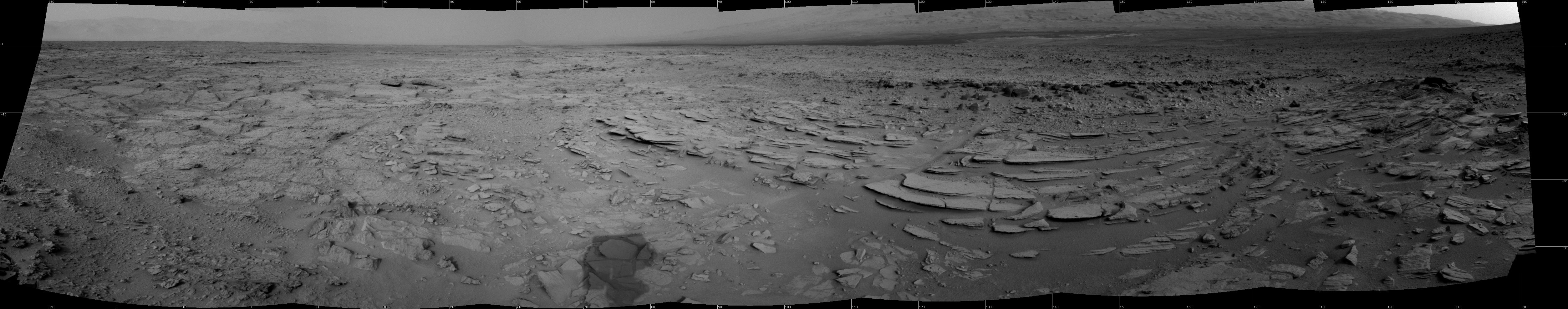
English: PIA16551: Sol 120 Panorama from Curiosity, near 'Shaler'
http://photojournal.jpl.nasa.gov/catalog/PIA16551 Target Name: Mars Is a satellite of: Sol (our sun) Mission: Mars Science Laboratory (MSL) Spacecraft: Mars Science Laboratory (MSL) Instrument: Navcam (MSL) Product Size: 5012 x 988 pixels (width x height) Produced By: JPL Full-Res TIFF: PIA16551.tif (4.96 MB) Full-Res JPEG: PIA16551.jpg (606.5 kB) Click on the image above to download a moderately sized image in JPEG format (possibly reduced in size from original) Original Caption Released with Image: The NASA Mars rover Curiosity used its Navigation Camera (Navcam) during the mission's 120th Martian day, or sol (Dec. 7, 2012), to record the seven images combined into this panoramic view. The scene spans from north-northwest at the left to south-southwest at the right, and is presented in a cylindrical projection. The layered outcrop in the foreground is called "Shaler." NASA's Jet Propulsion Laboratory, a division of the California Institute of Technology, Pasadena, manages the Mars Science Laboratory Project for NASA's Science Mission Directorate, Washington. JPL designed and built the project's Curiosity rover. For more about NASA's Curiosity mission, visit: http://www.jpl.nasa.gov/msl, http://www.nasa.gov/mars, and http://mars.jpl.nasa.gov/msl. Image Credit: NASA/JPL-Caltech Image Addition Date: 2012-12-11 |
| 日期 | |
| 來源 | http://photojournal.jpl.nasa.gov/jpeg/PIA16551.jpg |
| 作者 | NASA/JPL-Caltech |
授權條款
| 本作品由NASA創作,屬於公有領域。根據NASA的版權政策:“NASA的創作除非另有聲明否則不受版權保護。”(參見:Template:PD-USGov/zh,NASA版權政策或JPL圖像使用政策) | ||
 |
警告:
|
檔案歷史
點選日期/時間以檢視該時間的檔案版本。
| 日期/時間 | 縮圖 | 尺寸 | 用戶 | 備註 | |
|---|---|---|---|---|---|
| 目前 | 2012年12月12日 (三) 14:09 | 5,012 × 988(592 KB) | Drbogdan | User created page with UploadWizard |
檔案用途
下列頁面有用到此檔案:
全域檔案使用狀況
以下其他 wiki 使用了這個檔案:
- en.wikipedia.org 的使用狀況
- lb.wikipedia.org 的使用狀況
- ru.wikipedia.org 的使用狀況
- vi.wikipedia.org 的使用狀況