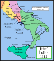
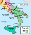
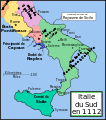
File:Southern Italy 1112.svg

此 SVG 檔案的 PNG 預覽的大小:529 × 600 像素。 其他解析度:212 × 240 像素 | 423 × 480 像素 | 678 × 768 像素 | 903 × 1,024 像素 | 1,807 × 2,048 像素 | 712 × 807 像素。
原始檔案 (SVG 檔案,表面大小:712 × 807 像素,檔案大小:652 KB)
檔案歷史
點選日期/時間以檢視該時間的檔案版本。
| 日期/時間 | 縮圖 | 尺寸 | 用戶 | 備註 | |
|---|---|---|---|---|---|
| 目前 | 2008年1月9日 (三) 17:29 |  | 712 × 807(652 KB) | Salli~commonswiki | |
| 2007年4月16日 (一) 21:12 |  | 712 × 807(739 KB) | MapMaster | Slightly modified version | |
| 2006年12月20日 (三) 16:32 |  | 712 × 807(739 KB) | MapMaster | Fixed typo, added Taranto | |
| 2006年12月16日 (六) 14:15 |  | 712 × 807(729 KB) | MapMaster | A political map of southern Italy in 1112 AD/CE, the date when Roger II of Sicily reached his age of majority. |
檔案用途
全域檔案使用狀況
以下其他 wiki 使用了這個檔案:
- ar.wikipedia.org 的使用狀況
- arz.wikipedia.org 的使用狀況
- azb.wikipedia.org 的使用狀況
- bg.wikipedia.org 的使用狀況
- ca.wikipedia.org 的使用狀況
- cs.wikipedia.org 的使用狀況
- da.wikipedia.org 的使用狀況
- de.wikipedia.org 的使用狀況
- el.wikipedia.org 的使用狀況
- en.wikipedia.org 的使用狀況
- Manuel I Komnenos
- Roger II of Sicily
- List of historical states of Italy
- Southern Italy
- Duchy of Naples
- Jordan II of Capua
- Robert II of Capua
- Alfonso of Capua
- Ranulf II of Alife
- Battle of Nocera
- Sergius VII of Naples
- Battle of Rignano
- User:MapMaster
- Byzantine–Norman wars
- County of Sicily
- County of Apulia and Calabria
- 1137 in Italy
- Bianco d'Alessano
- Cesina family
- User:Falcaorib/Italy
- eo.wikipedia.org 的使用狀況
- et.wikipedia.org 的使用狀況
檢視此檔案的更多全域使用狀況。


